105 Shepherd's Lane Benchmark
Introduction
The photograph on this page of 105 Shepherd's Lane Benchmark by Anthony Rowley as part of the Geograph project.
The Geograph project started in 2005 with the aim of publishing, organising and preserving representative images for every square kilometre of Great Britain, Ireland and the Isle of Man.

There are currently over 7.5m images from over 14,400 individuals and you can help contribute to the project by visiting https://www.geograph.org.uk
105 Shepherd's Lane Benchmark
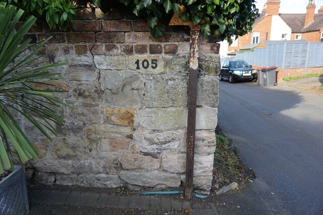
Image: © Anthony Rowley Taken: 25 Oct 2021
The OS Cut Benchmark on the boundary wall of 105 Shepherd's Lane, Redlake, Telford. It is 0.8-metres above the ground and 142.99-metres the above Ordnance Datum at Newlyn. It was cut between 1925 to 1937 and last verified by the OS in 1960.
Images are licensed for reuse under creativecommons.org/licenses/by-sa/2.0
Image Location
Latitude
52.695065
Longitude
-2.471962