1912 City of Carlisle boundary stone on NE side of London Road
Introduction
The photograph on this page of 1912 City of Carlisle boundary stone on NE side of London Road by Roger Templeman as part of the Geograph project.
The Geograph project started in 2005 with the aim of publishing, organising and preserving representative images for every square kilometre of Great Britain, Ireland and the Isle of Man.

There are currently over 7.5m images from over 14,400 individuals and you can help contribute to the project by visiting https://www.geograph.org.uk
1912 City of Carlisle boundary stone on NE side of London Road
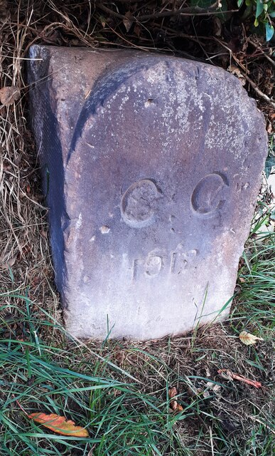
Image: © Roger Templeman Taken: 21 Oct 2021
In grass verge of the A6 on the line of the northern boundary of #419 London Road, the stone has the Milestone Society National ID: CU_CL03pb
Images are licensed for reuse under creativecommons.org/licenses/by-sa/2.0
Image Location
Latitude
54.873458
Longitude
-2.901159