Mangotsfield remembers
Introduction
The photograph on this page of Mangotsfield remembers by Neil Owen as part of the Geograph project.
The Geograph project started in 2005 with the aim of publishing, organising and preserving representative images for every square kilometre of Great Britain, Ireland and the Isle of Man.

There are currently over 7.5m images from over 14,400 individuals and you can help contribute to the project by visiting https://www.geograph.org.uk
Mangotsfield remembers
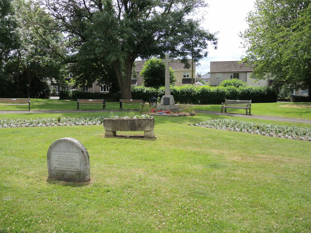
Image: © Neil Owen Taken: 24 Jun 2021
A patch of greenery now exists directly south of the old triangle that was the historic part of Mangotsfield. The area was remodelled in the post-war period and some buildings cleared to provide the present space. The war memorial has been moved here, along with some flowers and other items. The rounded stone in the foreground bears tribute to a local councillor and chairman of the British Legion.
Images are licensed for reuse under creativecommons.org/licenses/by-sa/2.0
Image Location
Latitude
51.482399
Longitude
-2.485109