
A walk around the Fosse Way [67]
Introduction
The photograph on this page of A walk around the Fosse Way [67] by Michael Dibb as part of the Geograph project.
The Geograph project started in 2005 with the aim of publishing, organising and preserving representative images for every square kilometre of Great Britain, Ireland and the Isle of Man.

There are currently over 7.5m images from over 14,400 individuals and you can help contribute to the project by visiting https://www.geograph.org.uk
A walk around the Fosse Way [67]
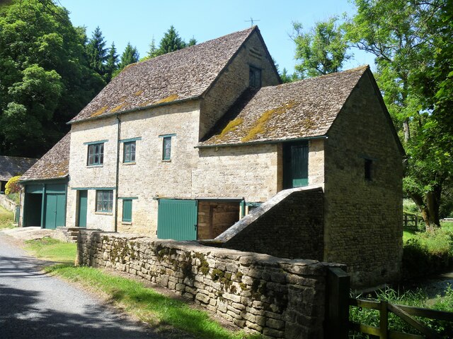
Image: © Michael Dibb Taken: 15 Jun 2021
This former mill on the River Coln is Stowell Mill. Built in the late 18th century with later extensions to both sides. Constructed of coursed stone with dressed stone to the openings, all under a stone slate roof. Listed, grade II, with details at: https://historicengland.org.uk/listing/the-list/list-entry/1152555 Starting at Fossebridge, where the Fosse Way descends precipitously to cross the River Coln, the walk gently ascends on a road and then a bridleway to meet a minor road which is part of the Salt Way. After using the Salt Way to cross the Fosse Way the route descends on footpaths and minor roads via Oxpens Farm and Stowell Mill to return to Fossebridge.
Images are licensed for reuse under creativecommons.org/licenses/by-sa/2.0
Image Location

Latitude
51.815113
Longitude
-1.882872