Jenner Hall, Cricklade parish hall
Introduction
The photograph on this page of Jenner Hall, Cricklade parish hall by Jeff Gogarty as part of the Geograph project.
The Geograph project started in 2005 with the aim of publishing, organising and preserving representative images for every square kilometre of Great Britain, Ireland and the Isle of Man.

There are currently over 7.5m images from over 14,400 individuals and you can help contribute to the project by visiting https://www.geograph.org.uk
Jenner Hall, Cricklade parish hall
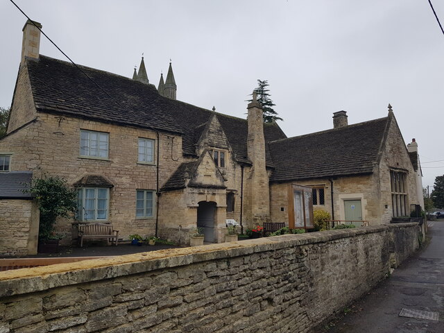
Image: © Jeff Gogarty Taken: 16 Oct 2021
Formerly Jenner's School, on Bath Road. It was built in 1652 and then became a workhouse before reverting to a school again in the 19th century. The rear facing the churchyard can be seen in Image
Images are licensed for reuse under creativecommons.org/licenses/by-sa/2.0
Image Location
Latitude
51.641026
Longitude
-1.857612