Brown's Buildings, Kenton Bank Foot
Introduction
The photograph on this page of Brown's Buildings, Kenton Bank Foot by Phil Thirkell as part of the Geograph project.
The Geograph project started in 2005 with the aim of publishing, organising and preserving representative images for every square kilometre of Great Britain, Ireland and the Isle of Man.

There are currently over 7.5m images from over 14,400 individuals and you can help contribute to the project by visiting https://www.geograph.org.uk
Brown's Buildings, Kenton Bank Foot
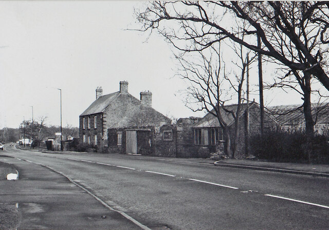
Image: © Phil Thirkell Taken: Unknown
The following description is taken from A Guide to the Industrial Archaeology of Tyne & Wear, compiled by Ian Ayris & Stafford M Linsley (1994): "The dilapidated remains of a smithy which was formerly part of the early nineteenth century group of buildings at bank foot. Some details can still be discerned including the iron tyre ring inlaid in the smithy floor. A site unlikely to survive future development." The photograph isn't precisely dated but was almost certainly taken in the late 1990s shortly before the buildings were demolished and the Twin Farms public house built on the site. The lamp-post with a "Station" sign, and the bus stop, are still there indicating a precise location.
Images are licensed for reuse under creativecommons.org/licenses/by-sa/2.0
Image Location
Latitude
55.015215
Longitude
-1.678136