Boundary Stone, Peak Plantation, Birdlip
Introduction
The photograph on this page of Boundary Stone, Peak Plantation, Birdlip by Mr Red as part of the Geograph project.
The Geograph project started in 2005 with the aim of publishing, organising and preserving representative images for every square kilometre of Great Britain, Ireland and the Isle of Man.

There are currently over 7.5m images from over 14,400 individuals and you can help contribute to the project by visiting https://www.geograph.org.uk
Boundary Stone, Peak Plantation, Birdlip
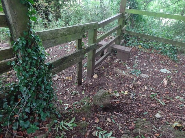
Image: © Mr Red Taken: 11 Oct 2021
At the stile and apex of the boundary. Cowley (inc Birdlip) is to the SE, Badgeworth is N, S & W. There is no visible inscription but other Boundary Stones along the ridge bear the letters C M & 1857. See other stones along the ridge https://www.geograph.org.uk/discuss/index.php?&action=vthread&forum=11&topic=32582 Milestone Society National ID: GL_BADCOW05pb
Images are licensed for reuse under creativecommons.org/licenses/by-sa/2.0
Image Location
Latitude
51.834716
Longitude
-2.114037