Downderry - Beach and view to Rame Head
Introduction
The photograph on this page of Downderry - Beach and view to Rame Head by Rob Farrow as part of the Geograph project.
The Geograph project started in 2005 with the aim of publishing, organising and preserving representative images for every square kilometre of Great Britain, Ireland and the Isle of Man.

There are currently over 7.5m images from over 14,400 individuals and you can help contribute to the project by visiting https://www.geograph.org.uk
Downderry - Beach and view to Rame Head
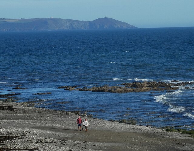
Image: © Rob Farrow Taken: 8 Oct 2021
Downderry's shingly beach is similar to that at nearby Seaton - if you want sand you have to travel a few miles further east to Whitsand Bay. Guarding the end of that bay is the peninsula of Rame Head, seen in the distance in this image. It has a little abandoned chapel on top which can be seen as a pimple in this image. (see Image])
Images are licensed for reuse under creativecommons.org/licenses/by-sa/2.0
Image Location
Latitude
50.360565
Longitude
-4.3699