Tyn y Garn to Tyrisha
Introduction
The photograph on this page of Tyn y Garn to Tyrisha by Colin Prosser as part of the Geograph project.
The Geograph project started in 2005 with the aim of publishing, organising and preserving representative images for every square kilometre of Great Britain, Ireland and the Isle of Man.

There are currently over 7.5m images from over 14,400 individuals and you can help contribute to the project by visiting https://www.geograph.org.uk
Tyn y Garn to Tyrisha
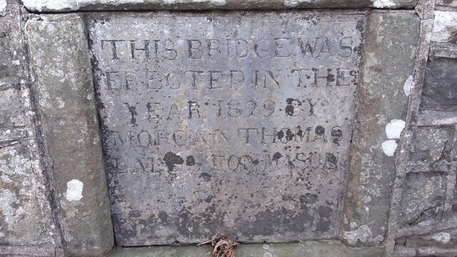
Image: © Colin Prosser Taken: 26 Dec 2016
The lanes between Tyn y Garn and Tyrisha, the inscription on old stone bridge, over the river Ogmore, commonly known as Swanee Bridge, this was a former horse drawn tram road, to take coal from the valleys to Bridgend and onto Porthcawl for export
Images are licensed for reuse under creativecommons.org/licenses/by-sa/2.0
Image Location
Latitude
51.533062
Longitude
-3.588994