Clun houses [28]
Introduction
The photograph on this page of Clun houses [28] by Michael Dibb as part of the Geograph project.
The Geograph project started in 2005 with the aim of publishing, organising and preserving representative images for every square kilometre of Great Britain, Ireland and the Isle of Man.

There are currently over 7.5m images from over 14,400 individuals and you can help contribute to the project by visiting https://www.geograph.org.uk
Clun houses [28]
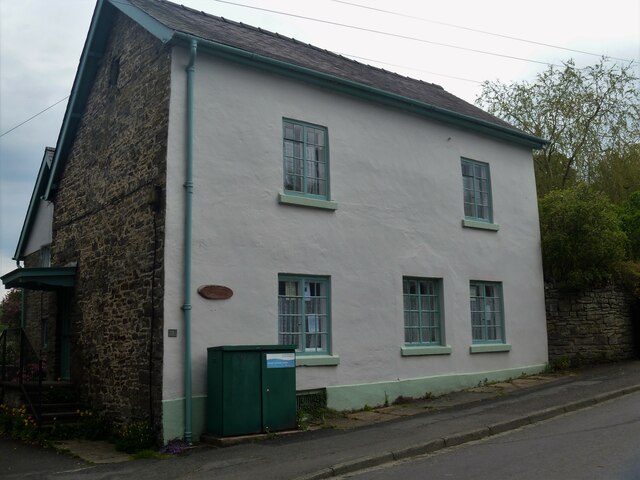
Image: © Michael Dibb Taken: 2 Jun 2021
Castle Farmhouse, number 9 Church Street, was built in the 17th century and partly remodelled, rebuilt and extended in the mid 19th century. Probably timber framed, partly rebuilt and extended in coursed rubble stone, all under slate roof. Listed, grade II, with details at: https://historicengland.org.uk/listing/the-list/list-entry/1367255 The small town of Clun is astride the River Clun in the Shropshire Hills Area of Outstanding Natural Beauty. It is located some 14 miles northwest of Ludlow and some 5½ miles north of Knighton. There is evidence of settlement in the Neolithic period but the town grew around the site of an Anglo-Saxon church. The Normans built a castle and a new town was laid out, the grid plan of which survives in this tranquil valley.
Images are licensed for reuse under creativecommons.org/licenses/by-sa/2.0
Image Location
Latitude
52.419977
Longitude
-3.030139