25-29 Lower Holyhead Road
Introduction
The photograph on this page of 25-29 Lower Holyhead Road by Alan Murray-Rust as part of the Geograph project.
The Geograph project started in 2005 with the aim of publishing, organising and preserving representative images for every square kilometre of Great Britain, Ireland and the Isle of Man.

There are currently over 7.5m images from over 14,400 individuals and you can help contribute to the project by visiting https://www.geograph.org.uk
25-29 Lower Holyhead Road
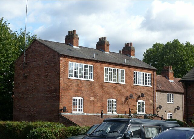
Image: © Alan Murray-Rust Taken: 23 Sep 2021
Cottages with top floor workshops, either for weaving or watch-making. Early 19th century, complete by 1837, Listed Grade II. This is the rear view.
Images are licensed for reuse under creativecommons.org/licenses/by-sa/2.0
Image Location
Latitude
52.409282
Longitude
-1.518218