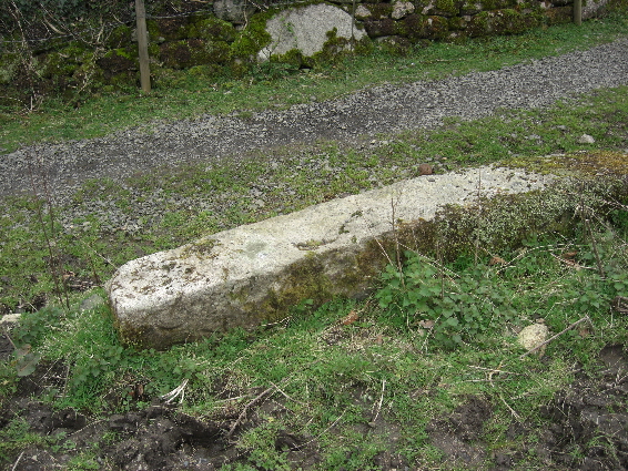
Old Boundary Marker in South Zeal village
Introduction
The photograph on this page of Old Boundary Marker in South Zeal village by T Jenkinson as part of the Geograph project.
The Geograph project started in 2005 with the aim of publishing, organising and preserving representative images for every square kilometre of Great Britain, Ireland and the Isle of Man.
There are currently over 7.5m images from over 14,400 individuals and you can help contribute to the project by visiting https://www.geograph.org.uk

Image: © T Jenkinson Taken: 21 Mar 2008
Parish Boundary Marker lying as an edging stone beside the public footpath from South Zeal village through Mill Field towards Hillfield and Croft. South Tawton parish. Inscribed D C / 4 (Duchy of Cornwall) and S Z / 4 (South Zeal citizens) on opposite faces. The stone is one of four stones (SZ1-SZ4) erected in 1895 on South Tawton Common by the Duchy of Cornwall to mark the boundary of their land and prevent encroachment on the Common by villagers, farmers and residents of the parish. The stone was originally located at SX654922, as evidenced by a conveyance held in the Devon Record Office by which the Duchy of Cornwall and 44 ‘purchasers’ legalised 108 enclosures of land which had been subject to dispute. Milestone Society National ID: DV_SZ04pb

