The Greyhound Inn
Introduction
The photograph on this page of The Greyhound Inn by Ian Capper as part of the Geograph project.
The Geograph project started in 2005 with the aim of publishing, organising and preserving representative images for every square kilometre of Great Britain, Ireland and the Isle of Man.

There are currently over 7.5m images from over 14,400 individuals and you can help contribute to the project by visiting https://www.geograph.org.uk
The Greyhound Inn
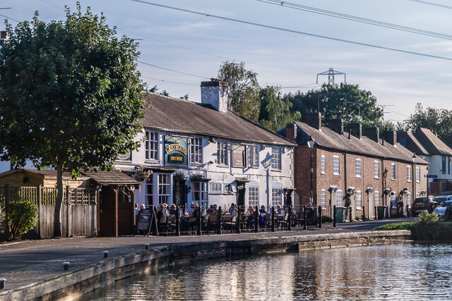
Image: © Ian Capper Taken: 23 Sep 2021
Early - mid 19th Century pub alongside the Oxford Canal at Hawkesbury Junction, the point where it meets the Coventry Canal. The terrace beyond is of the same period. Both are grade II listed - see www.historicengland.org.uk/listing/the-list/list-entry/1265692 and www.historicengland.org.uk/listing/the-list/list-entry/1226778 respectively.
Images are licensed for reuse under creativecommons.org/licenses/by-sa/2.0
Image Location
Latitude
52.457341
Longitude
-1.469364