Lower Bridge, Boscastle
Introduction
The photograph on this page of Lower Bridge, Boscastle by Stephen McKay as part of the Geograph project.
The Geograph project started in 2005 with the aim of publishing, organising and preserving representative images for every square kilometre of Great Britain, Ireland and the Isle of Man.

There are currently over 7.5m images from over 14,400 individuals and you can help contribute to the project by visiting https://www.geograph.org.uk
Lower Bridge, Boscastle
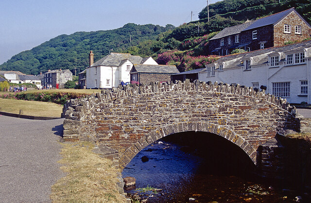
Image: © Stephen McKay Taken: Unknown
Boscastle is seen here on a fine day in the summer of 2001, three years before the disastrous flood that severely damaged the village including the lower bridge over the River Valency. The bridge was repaired but later replaced with a new bridge of a completely different design.
Images are licensed for reuse under creativecommons.org/licenses/by-sa/2.0
Image Location
Latitude
50.690335
Longitude
-4.695163