Severn Way south-east of Upper Arley, Worcestershire
Introduction
The photograph on this page of Severn Way south-east of Upper Arley, Worcestershire by Roger Kidd as part of the Geograph project.
The Geograph project started in 2005 with the aim of publishing, organising and preserving representative images for every square kilometre of Great Britain, Ireland and the Isle of Man.

There are currently over 7.5m images from over 14,400 individuals and you can help contribute to the project by visiting https://www.geograph.org.uk
Severn Way south-east of Upper Arley, Worcestershire
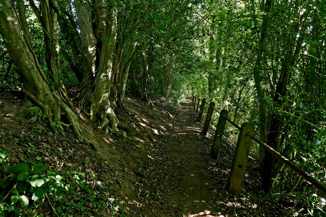
Image: © Roger Kidd Taken: 20 Sep 2021
Looking south-south-east towards Trimpley Reservoir and Eymore Wood. The public footpath by the River Severn passes through dense woodland. The land drops very steeply off to the right, down to the river. The Severn Way and the North Worcestershire Path both pass this way.
Images are licensed for reuse under creativecommons.org/licenses/by-sa/2.0
Image Location


Leaflet Map data © OpenStreetMap
Latitude
52.416868
Longitude
-2.342538