Old Boundary Marker on the B6164 Knaresborough Road
Introduction
The photograph on this page of Old Boundary Marker on the B6164 Knaresborough Road by P Robertson as part of the Geograph project.
The Geograph project started in 2005 with the aim of publishing, organising and preserving representative images for every square kilometre of Great Britain, Ireland and the Isle of Man.

There are currently over 7.5m images from over 14,400 individuals and you can help contribute to the project by visiting https://www.geograph.org.uk
Old Boundary Marker on the B6164 Knaresborough Road
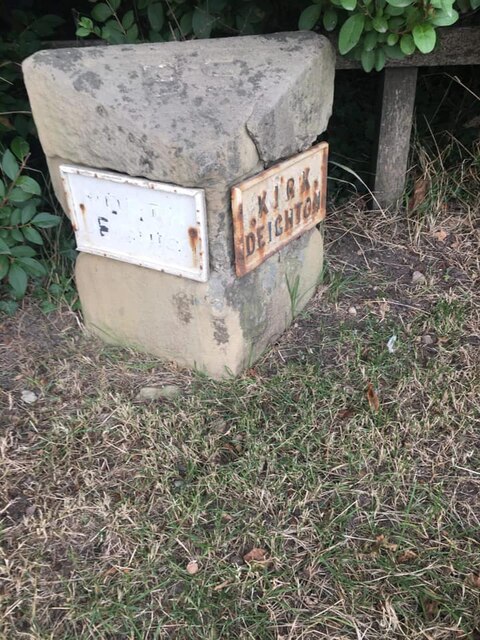
Image: © P Robertson Taken: 24 Sep 2021
Parish Boundary Marker on the northeast side of the B6164 Knaresborough Road opposite Woodlands Farm and beside village entry sign. On the boundary of Kirk Deighton and North Deighton. NORTH / DEIGHTON and KIRK / DEIGHTON in raised lettering on plates on adjacent faces of the stone. Formerly a township in Kirk Deighton parish, North Deighton was made a separate parish in 1866 and the stone probably dates from then. Milestone Society National ID: YW_KDENDE01pb
Images are licensed for reuse under creativecommons.org/licenses/by-sa/2.0
Image Location
Latitude
53.952878
Longitude
-1.398319