Castle Place and Friar Lane
Introduction
The photograph on this page of Castle Place and Friar Lane by John Sutton as part of the Geograph project.
The Geograph project started in 2005 with the aim of publishing, organising and preserving representative images for every square kilometre of Great Britain, Ireland and the Isle of Man.

There are currently over 7.5m images from over 14,400 individuals and you can help contribute to the project by visiting https://www.geograph.org.uk
Castle Place and Friar Lane
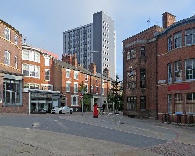
Image: © John Sutton Taken: 22 Sep 2021
Friar Lane (ahead) leads down to the Market Square and Castle Road is to the right. Maid Marian Way and its undistinguished tower blocks made a mess of a swathe of the city in the 1950s and sixties. The picture was taken at about nine o'clock on a fine late-September morning.
Images are licensed for reuse under creativecommons.org/licenses/by-sa/2.0
Image Location
Latitude
52.951125
Longitude
-1.15367