Old Boundary Marker on Longridge Road, Plymouth
Introduction
The photograph on this page of Old Boundary Marker on Longridge Road, Plymouth by T Jenkinson as part of the Geograph project.
The Geograph project started in 2005 with the aim of publishing, organising and preserving representative images for every square kilometre of Great Britain, Ireland and the Isle of Man.

There are currently over 7.5m images from over 14,400 individuals and you can help contribute to the project by visiting https://www.geograph.org.uk
Old Boundary Marker on Longridge Road, Plymouth
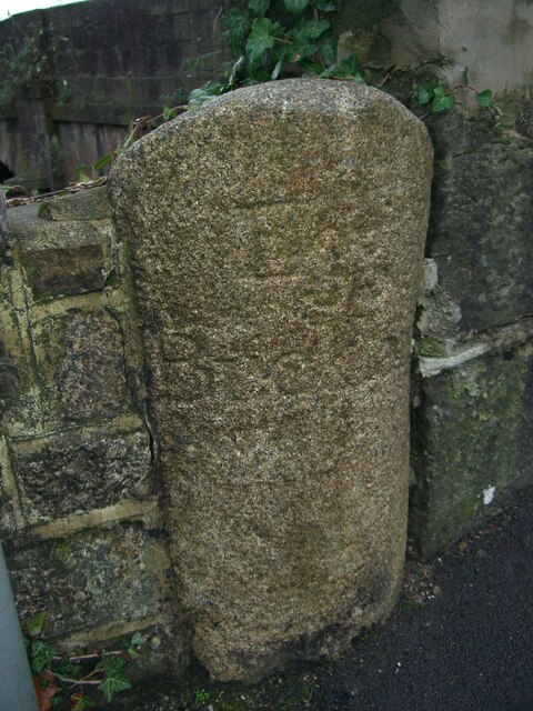
Image: © T Jenkinson Taken: 31 Dec 2007
Parish Boundary Marker between the west end of the parapet of Long Bridge and a stone wall on the east side of Longbridge Road, just off the B3416 Plymouth Road. Inscribed Egg / Buckland. Until 1939 this marked the boundary of Egg Buckland and Plympton St Mary parishes, after which Egg Buckland became part of Plymouth parish and borough. Milestone Society National ID: DV_PLEX02apb
Images are licensed for reuse under creativecommons.org/licenses/by-sa/2.0
Image Location
Latitude
50.392057
Longitude
-4.084322