Liverpool Road, Islington: west side, view south
Introduction
The photograph on this page of Liverpool Road, Islington: west side, view south by Stefan Czapski as part of the Geograph project.
The Geograph project started in 2005 with the aim of publishing, organising and preserving representative images for every square kilometre of Great Britain, Ireland and the Isle of Man.

There are currently over 7.5m images from over 14,400 individuals and you can help contribute to the project by visiting https://www.geograph.org.uk
Liverpool Road, Islington: west side, view south
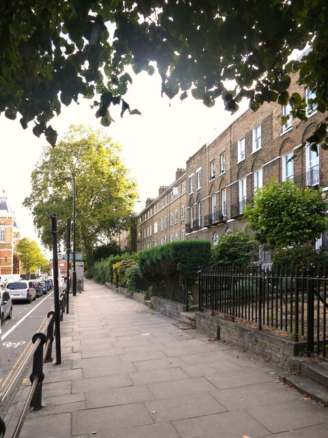
Image: © Stefan Czapski Taken: 22 Sep 2021
Seen from a point just across the road from Old Royal Free Place (once the entrance to the hospital of that name). The first few houses - with tall first-floor windows - date from the early 1800's. Further along, the houses with chimneys showing are replacements, probably made necessary by WW2 bomb damage.
Images are licensed for reuse under creativecommons.org/licenses/by-sa/2.0
Image Location
Latitude
51.536478
Longitude
-0.107411