Old Boundary Markers in back Wilton Street, Plymouth
Introduction
The photograph on this page of Old Boundary Markers in back Wilton Street, Plymouth by T Jenkinson as part of the Geograph project.
The Geograph project started in 2005 with the aim of publishing, organising and preserving representative images for every square kilometre of Great Britain, Ireland and the Isle of Man.

There are currently over 7.5m images from over 14,400 individuals and you can help contribute to the project by visiting https://www.geograph.org.uk
Old Boundary Markers in back Wilton Street, Plymouth
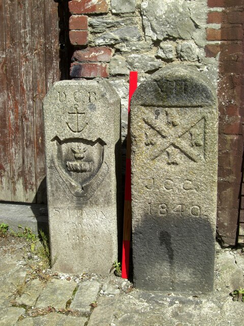
Image: © T Jenkinson Taken: 16 May 2012
Two Municipal Boundary Markers against the rear wall of a house in the back lane of Wilton Street, Plymouth. On the left is Devonport municipal borough boundary marker DV_DCBB14pb. Inscribed D.C. B. / St LEVAN / MAYOR / 1891. St Levan was The Right Honourable John, Lord Saint Levan. On the right is Plymouth borough boundary marker DV_PCBS15pb. Inscribed VII / J.C.C. / 1840. J.C.C. refers to Joseph C Cookworthy, mayor.
Images are licensed for reuse under creativecommons.org/licenses/by-sa/2.0
Image Location
Latitude
50.376869
Longitude
-4.154698