Stoneywell
Introduction
The photograph on this page of Stoneywell by Stephen McKay as part of the Geograph project.
The Geograph project started in 2005 with the aim of publishing, organising and preserving representative images for every square kilometre of Great Britain, Ireland and the Isle of Man.

There are currently over 7.5m images from over 14,400 individuals and you can help contribute to the project by visiting https://www.geograph.org.uk
Stoneywell
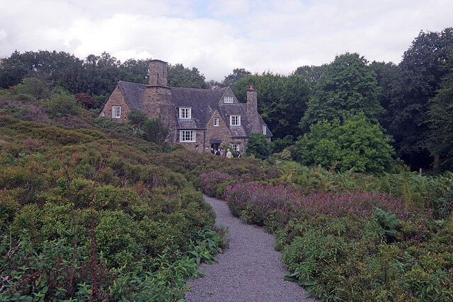
Image: © Stephen McKay Taken: 17 Sep 2021
Visitors approach the house along the path in the foreground. By the door a group of National Trust volunteers give an introductory talk to visitors before they enter the property.
Images are licensed for reuse under creativecommons.org/licenses/by-sa/2.0
Image Location
Latitude
52.701413
Longitude
-1.264763