Pant and trough in North Sunderland
Introduction
The photograph on this page of Pant and trough in North Sunderland by Richard Law as part of the Geograph project.
The Geograph project started in 2005 with the aim of publishing, organising and preserving representative images for every square kilometre of Great Britain, Ireland and the Isle of Man.

There are currently over 7.5m images from over 14,400 individuals and you can help contribute to the project by visiting https://www.geograph.org.uk
Pant and trough in North Sunderland
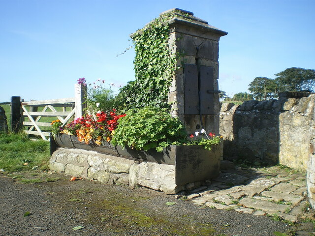
Image: © Richard Law Taken: 7 Sep 2021
Located at the west end of the village, this 19th century drinking trough and well were Grade II listed https://britishlistedbuildings.co.uk/101234763-pant-and-trough-at-west-end-of-village-north-sunderland#.YUjITbhKjIU & https://historicengland.org.uk/listing/the-list/list-entry/1234763 in late 1969. There is another pump Image, very similar in construction, closer in towards the town centre.
Images are licensed for reuse under creativecommons.org/licenses/by-sa/2.0
Image Location
Latitude
55.575043
Longitude
-1.670294