Site of planned Grange View Building Development
Introduction
The photograph on this page of Site of planned Grange View Building Development by Google Maps as part of the Geograph project.
The Geograph project started in 2005 with the aim of publishing, organising and preserving representative images for every square kilometre of Great Britain, Ireland and the Isle of Man.

There are currently over 7.5m images from over 14,400 individuals and you can help contribute to the project by visiting https://www.geograph.org.uk
Site of planned Grange View Building Development
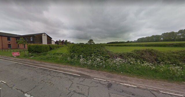
Image: © Google Maps Taken: 1 Jul 2018
Photograph from Grange Road of fields that will be developed into the Grange View housing estate. Taken approx 2018. On the left is the Hugglescote Surgery. This view is roughly where the entrance to Percival Road will be built in 2020.
Images are licensed for reuse under creativecommons.org/licenses/by-sa/2.0
Image Location
Latitude
52.710434
Longitude
-1.363487