Wigmore features [2]
Introduction
The photograph on this page of Wigmore features [2] by Michael Dibb as part of the Geograph project.
The Geograph project started in 2005 with the aim of publishing, organising and preserving representative images for every square kilometre of Great Britain, Ireland and the Isle of Man.

There are currently over 7.5m images from over 14,400 individuals and you can help contribute to the project by visiting https://www.geograph.org.uk
Wigmore features [2]
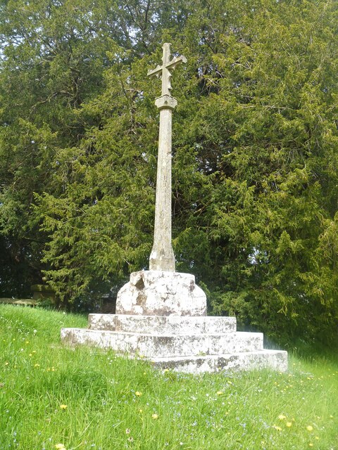
Image: © Michael Dibb Taken: 1 Jun 2021
In the churchyard of the church of St James is this cross with a 14th century base. The plinth and the shaft and cross are all from the 19th century restoration. Listed, grade II, with details at: https://historicengland.org.uk/listing/the-list/list-entry/1349895 The village of Wigmore is set astride the A4110 road some 8 miles west of Ludlow in the northwest part of Herefordshire. An Anglo-Saxon village which, after the building of the castle, became a small but thriving market town. Wigmore declined when the castle owners moved their administrative centre to Ludlow and reverted to village status.
Images are licensed for reuse under creativecommons.org/licenses/by-sa/2.0
Image Location
Latitude
52.316402
Longitude
-2.862398