Old Boundary Marker by Wetheriggs, Clifton parish
Introduction
The photograph on this page of Old Boundary Marker by Wetheriggs, Clifton parish by M Rayner as part of the Geograph project.
The Geograph project started in 2005 with the aim of publishing, organising and preserving representative images for every square kilometre of Great Britain, Ireland and the Isle of Man.

There are currently over 7.5m images from over 14,400 individuals and you can help contribute to the project by visiting https://www.geograph.org.uk
Old Boundary Marker by Wetheriggs, Clifton parish
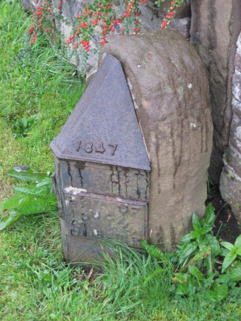
Image: © M Rayner Taken: 30 Sep 2017
Parish Boundary Marker by the UC road (was A686), in parish of Clifton (Eden District), by Clifton Dykes Cottages, on verge, South side of road, opposite Moor Lane. The raised lettering on each face reads:- 1847 / PH OF / (CLIFTON / 1847 broken off) 1847 / PH OF / BROUGHAM / 1847 Grade II listed. List Entry Number: 1099905 https://historicengland.org.uk/listing/the-list/list-entry/1099905 Surveyed Milestone Society National ID: WE_ALPR01pb
Images are licensed for reuse under creativecommons.org/licenses/by-sa/2.0
Image Location
Latitude
54.638048
Longitude
-2.709045