Mill Lane Independent Methodist Church
Introduction
The photograph on this page of Mill Lane Independent Methodist Church by Neil Owen as part of the Geograph project.
The Geograph project started in 2005 with the aim of publishing, organising and preserving representative images for every square kilometre of Great Britain, Ireland and the Isle of Man.

There are currently over 7.5m images from over 14,400 individuals and you can help contribute to the project by visiting https://www.geograph.org.uk
Mill Lane Independent Methodist Church
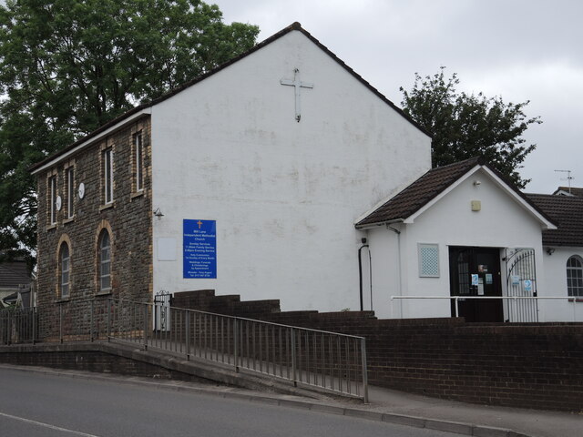
Image: © Neil Owen Taken: 19 Jun 2021
The Warmley area was once a place of heavy industry, with coal mines, quarrying and the Flock and Shoddy engineering works important employers in the nineteenth century. As is often the case when population numbers rise rapidly, there was a large uptake in church-going, particularly in the Methodist movement. However, the creation of several churches in the area proved to increase contention between various congregations. The Temperance Movement brought matters to a head and there was a split which resulted in this church being founded in 1899. The building was originally two small houses, and was enlarged after the Independents took over. A new hall was built in 1973 and the church continues its work to this day.
Images are licensed for reuse under creativecommons.org/licenses/by-sa/2.0
Image Location
Latitude
51.450157
Longitude
-2.475845