Old Boundary Markers on Beacon Park Road, Plymouth
Introduction
The photograph on this page of Old Boundary Markers on Beacon Park Road, Plymouth by T Jenkinson as part of the Geograph project.
The Geograph project started in 2005 with the aim of publishing, organising and preserving representative images for every square kilometre of Great Britain, Ireland and the Isle of Man.

There are currently over 7.5m images from over 14,400 individuals and you can help contribute to the project by visiting https://www.geograph.org.uk
Old Boundary Markers on Beacon Park Road, Plymouth
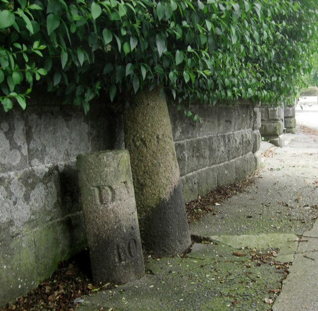
Image: © T Jenkinson Taken: 21 Jul 2012
Two boundary markers in Plymouth under a hedge and against a front garden wall on the north side of the junction of Beacon Park Road and Fircroft Road. On the left is Municipal Boundary Marker DV_DMBB01pb. Inscribed with an upwards pointing arrow and D.M.B. / 5 / 10.S for Devonport Municipal Borough. On the right is Parish Boundary Marker DV_WPBS01pb. Inscribed WESTON / P for Weston Peverell parish.
Images are licensed for reuse under creativecommons.org/licenses/by-sa/2.0
Image Location
Latitude
50.394576
Longitude
-4.156796