Presteigne features [8]
Introduction
The photograph on this page of Presteigne features [8] by Michael Dibb as part of the Geograph project.
The Geograph project started in 2005 with the aim of publishing, organising and preserving representative images for every square kilometre of Great Britain, Ireland and the Isle of Man.

There are currently over 7.5m images from over 14,400 individuals and you can help contribute to the project by visiting https://www.geograph.org.uk
Presteigne features [8]
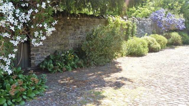
Image: © Michael Dibb Taken: 2 Jun 2021
Seen from Pound Lane is part of the wall surrounding The Rectory. Possibly dating from circa 1840, when The Rectory was rebuilt. A tall rubble stone wall topped with upright stones and supported by earth banks above the streets, it runs along Pound Lane then along the street known as West Wall before curving into St David's Street. Listed, grade II, with details at: https://cadwpublic-api.azurewebsites.net/reports/listedbuilding/FullReport?lang=&id=8909 Presteigne is a market town, set on the south bank of the River Lugg, some 19 miles northwest of Hereford and 16 miles east of Llandrindod Wells. The Welsh/English border wraps around three sides of the town, which probably began as a small settlement around a Minster church. Formerly the county town of the historic county of Radnorshire, it remains quiet, picturesque and unspoilt.
Images are licensed for reuse under creativecommons.org/licenses/by-sa/2.0
Image Location
Latitude
52.275334
Longitude
-3.007727