Presteigne houses [56]
Introduction
The photograph on this page of Presteigne houses [56] by Michael Dibb as part of the Geograph project.
The Geograph project started in 2005 with the aim of publishing, organising and preserving representative images for every square kilometre of Great Britain, Ireland and the Isle of Man.

There are currently over 7.5m images from over 14,400 individuals and you can help contribute to the project by visiting https://www.geograph.org.uk
Presteigne houses [56]
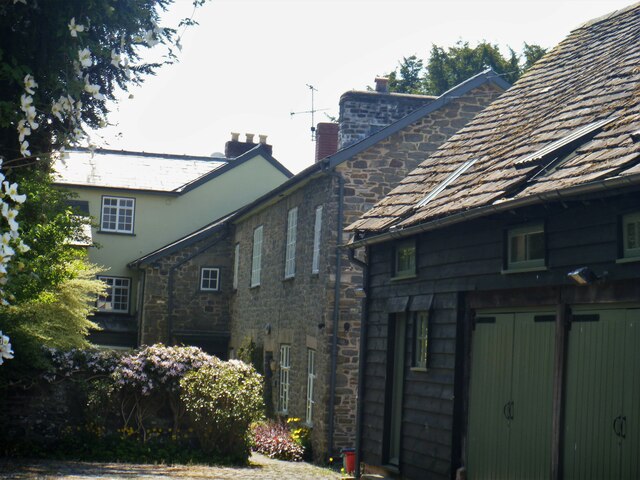
Image: © Michael Dibb Taken: 2 Jun 2021
Seen from Pound Lane is Manor Cottage, located between the Manor House and the Coach House. Built in, probably, the 18th century and altered and added to in the mid 19th century. Constructed in rubble stone under a slate roof. Listed, grade II, with details at: https://cadwpublic-api.azurewebsites.net/reports/listedbuilding/FullReport?lang=&id=8908 Presteigne is a market town, set on the south bank of the River Lugg, some 19 miles northwest of Hereford and 16 miles east of Llandrindod Wells. The Welsh/English border wraps around three sides of the town, which probably began as a small settlement around a Minster church. Formerly the county town of the historic county of Radnorshire, it remains quiet, picturesque and unspoilt.
Images are licensed for reuse under creativecommons.org/licenses/by-sa/2.0
Image Location
Latitude
52.275154
Longitude
-3.007723