Benchmark, Lady Gillford?s House garden wall
Introduction
The photograph on this page of Benchmark, Lady Gillford?s House garden wall by Adrian Taylor as part of the Geograph project.
The Geograph project started in 2005 with the aim of publishing, organising and preserving representative images for every square kilometre of Great Britain, Ireland and the Isle of Man.

There are currently over 7.5m images from over 14,400 individuals and you can help contribute to the project by visiting https://www.geograph.org.uk
Benchmark, Lady Gillford?s House garden wall
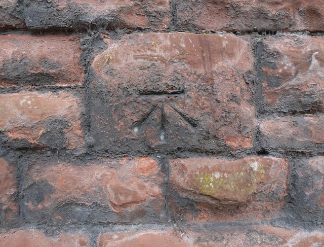
Image: © Adrian Taylor Taken: 12 Sep 2021
Detail of an Ordnance Survey cut benchmark on the garden wall of Lady Gillford’s House, facing onto Petteril Bank Road. The benchmark marks a height of 38.1717m above mean sea level (Ordnance Datum Newlyn) last verified in 1972 (location photograph Image). Lady Gillford’s House is the Carlisle Registration Office and the Carlisle Archive Centre.
Images are licensed for reuse under creativecommons.org/licenses/by-sa/2.0
Image Location
Latitude
54.874737
Longitude
-2.910382