Charter St Mission and Angel Fields Panorama
Introduction
The photograph on this page of Charter St Mission and Angel Fields Panorama by Glyn Baker as part of the Geograph project.
The Geograph project started in 2005 with the aim of publishing, organising and preserving representative images for every square kilometre of Great Britain, Ireland and the Isle of Man.

There are currently over 7.5m images from over 14,400 individuals and you can help contribute to the project by visiting https://www.geograph.org.uk
Charter St Mission and Angel Fields Panorama
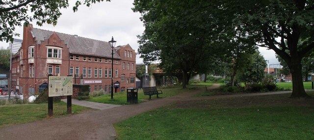
Image: © Glyn Baker Taken: 10 Sep 2021
The roots of the Charter St. Mission go back to the Ragged School Union and the Shaftsbury Society. Located adjacent to St Michaels Flags and Image The unbelievable poverty in the area was noted in the nineteenth century by none other than Fredrick Engels. What he saw here helped inform the authorship of his seminal work “The Condition of the Working Class in England”. Thankfully Image and Angel Meadow are now a quiet haven, an urban park just a few moments’ walk from the centre of Manchester’s bustle.
Images are licensed for reuse under creativecommons.org/licenses/by-sa/2.0
Image Location
Latitude
53.489637
Longitude
-2.236282