
Granary Wharf, 57 Commercial Road, Weymouth
Introduction
The photograph on this page of Granary Wharf, 57 Commercial Road, Weymouth by Jo and Steve Turner as part of the Geograph project.
The Geograph project started in 2005 with the aim of publishing, organising and preserving representative images for every square kilometre of Great Britain, Ireland and the Isle of Man.

There are currently over 7.5m images from over 14,400 individuals and you can help contribute to the project by visiting https://www.geograph.org.uk
Granary Wharf, 57 Commercial Road, Weymouth
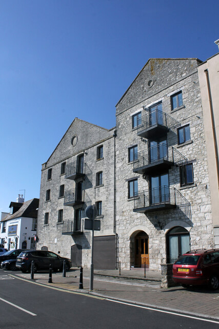
Image: © Jo and Steve Turner Taken: 22 Aug 2021
Former warehouses with two Grade II Listings as No.2 and No.4. Granary Quay. Now apartments, the fanlight over the main door appears to address almost the whole building 57 Granary Wharf. This is reflected in the OS map with No.4 Lower St Edmund Street in the rear of the eastern half. The slightly older western half is late 18th or early 19th century and the eastern half early 19th century. Built to the east of a former town bridge (replaced and moved 1769), the warehouses were converted in the 1980s receiving a Civic Society Award in 1988.
Images are licensed for reuse under creativecommons.org/licenses/by-sa/2.0
Image Location

Latitude
50.607483
Longitude
-2.455984