Old Boundary Marker on Newton Road, Kingskerswell parish
Introduction
The photograph on this page of Old Boundary Marker on Newton Road, Kingskerswell parish by T Jenkinson as part of the Geograph project.
The Geograph project started in 2005 with the aim of publishing, organising and preserving representative images for every square kilometre of Great Britain, Ireland and the Isle of Man.

There are currently over 7.5m images from over 14,400 individuals and you can help contribute to the project by visiting https://www.geograph.org.uk
Old Boundary Marker on Newton Road, Kingskerswell parish
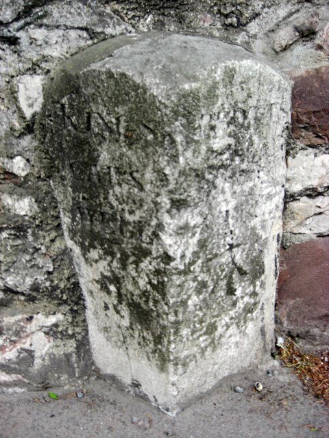
Image: © T Jenkinson Taken: 13 May 2011
Parish Boundary Marker set in a front garden wall on the west side of Newton Road almost opposite a petrol station, 200 metres south of the junction with Cole's Lane. Until 1935, when both were combined in Kerswells parish, the stone was on the boundary of Kingskerswell and Abbotskerswell. In 1984 the two parishes were separated again, but with a different boundary and the stone is now entirely in Kingskerswell parish. Inscribed KINGS / CARS / WELL and ABBOTS / (CARS) / WELL on adjacent faces. Milestone Society National ID: DV_TQEX05pb
Images are licensed for reuse under creativecommons.org/licenses/by-sa/2.0
Image Location
Latitude
50.503502
Longitude
-3.580122