Ridgmont Station from the A507 bridge
Introduction
The photograph on this page of Ridgmont Station from the A507 bridge by Bob Walters as part of the Geograph project.
The Geograph project started in 2005 with the aim of publishing, organising and preserving representative images for every square kilometre of Great Britain, Ireland and the Isle of Man.

There are currently over 7.5m images from over 14,400 individuals and you can help contribute to the project by visiting https://www.geograph.org.uk
Ridgmont Station from the A507 bridge
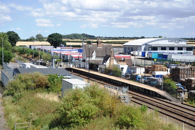
Image: © Bob Walters Taken: 28 Jul 2018
A view of Ridgmont Station looking east from the A507 bridge. The grey building in the middle left is the Network Rail Marston Vale Signalling Centre from where traffic on the Bletchley to Bedford line is controlled. The station building is now the Marston Vale Heritage Centre and Cafe.
Images are licensed for reuse under creativecommons.org/licenses/by-sa/2.0
Image Location
Latitude
52.02654
Longitude
-0.594917