Old Boundary Marker on the A386 near Southmoor Farm
Introduction
The photograph on this page of Old Boundary Marker on the A386 near Southmoor Farm by A Rosevear as part of the Geograph project.
The Geograph project started in 2005 with the aim of publishing, organising and preserving representative images for every square kilometre of Great Britain, Ireland and the Isle of Man.

There are currently over 7.5m images from over 14,400 individuals and you can help contribute to the project by visiting https://www.geograph.org.uk
Old Boundary Marker on the A386 near Southmoor Farm
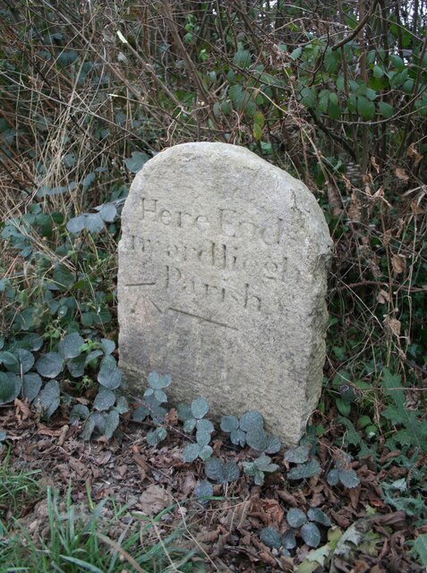
Image: © A Rosevear Taken: 29 Dec 2008
Parish Boundary Marker on Preston Moor, on a concrete plinth on the west side of the A386 immediately south of the drive to Southmoor farm. On the boundary of Inwardleigh and Jaconstowe parishes. Inscribed Here Ends / Inwardleigh / Parish above a horizontal groove. Erected by Okehampton Turnpike Trust around 1822. Milestone Society National ID: DV_OKHA03pb
Images are licensed for reuse under creativecommons.org/licenses/by-sa/2.0
Image Location
Latitude
50.782486
Longitude
-4.032992