Bethesda Chapel Flush Bracket Benchmark
Introduction
The photograph on this page of Bethesda Chapel Flush Bracket Benchmark by Anthony Rowley as part of the Geograph project.
The Geograph project started in 2005 with the aim of publishing, organising and preserving representative images for every square kilometre of Great Britain, Ireland and the Isle of Man.

There are currently over 7.5m images from over 14,400 individuals and you can help contribute to the project by visiting https://www.geograph.org.uk
Bethesda Chapel Flush Bracket Benchmark
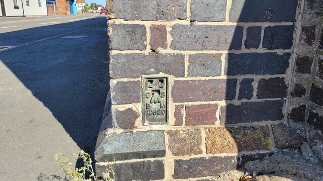
Image: © Anthony Rowley Taken: 7 Sep 2021
The OS Flush Bracket that is sited on the former Methodist Non-conformity chapel. The Flush Bracket was last verified by OS in 1958. It is 0.4-metres above the ground and 79.14-metres above the Newlyn datum. Bethesda Chapel was opened 4th November 1866. It is now a residential building.
Images are licensed for reuse under creativecommons.org/licenses/by-sa/2.0
Image Location
Latitude
52.713655
Longitude
-2.45363