Railway Entering Short Tunnel under Canal
Introduction
The photograph on this page of Railway Entering Short Tunnel under Canal by Ian Dodds as part of the Geograph project.
The Geograph project started in 2005 with the aim of publishing, organising and preserving representative images for every square kilometre of Great Britain, Ireland and the Isle of Man.

There are currently over 7.5m images from over 14,400 individuals and you can help contribute to the project by visiting https://www.geograph.org.uk
Railway Entering Short Tunnel under Canal
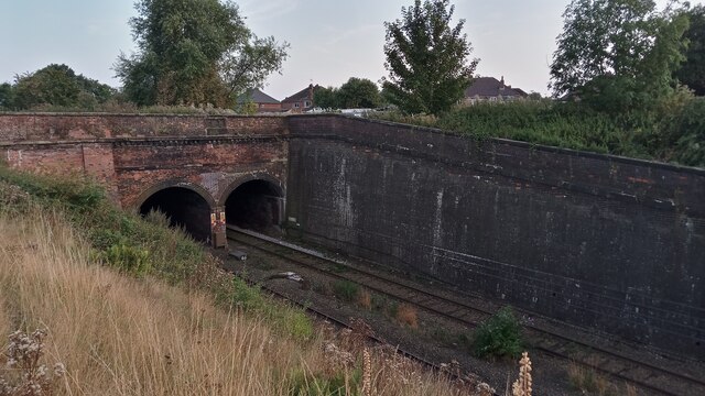
Image: © Ian Dodds Taken: 6 Sep 2021
I may be wrong, but I suspect this doesn't actually occur that often. The tunnel is marked as such on the initial 1870s OS map of the area, and although it looks like the bridge is carrying the canal, it isn't; the canal passes over the railway slightly further back than here. The very large field behind camera occupies an area formerly split into half a dozen or so smaller fields. One of the old dividing fences marked a parish boundary, and a boundary stone is still marked on today's maps. It isn't very obvious, though, where it is sited. Old maps show it as being on the upper slopes of the cutting (though pre-1900 maps only show a boundary stone on the far side of the railway) - it is either now not there, or buried under thick bracken, as I looked for it on the steep banks of the cutting, as well as the field behind. I have found no mention of this 'bridge' online. Hopefully some information does exist somewhere as I am curious about the two emblems in the centre of the parapet.
Images are licensed for reuse under creativecommons.org/licenses/by-sa/2.0
Image Location
Latitude
53.188864
Longitude
-2.849875