Two moated sites at Court Farm House, Fulbrook: aerial 2021
Introduction
The photograph on this page of Two moated sites at Court Farm House, Fulbrook: aerial 2021 by Simon Tomson as part of the Geograph project.
The Geograph project started in 2005 with the aim of publishing, organising and preserving representative images for every square kilometre of Great Britain, Ireland and the Isle of Man.

There are currently over 7.5m images from over 14,400 individuals and you can help contribute to the project by visiting https://www.geograph.org.uk
Two moated sites at Court Farm House, Fulbrook: aerial 2021
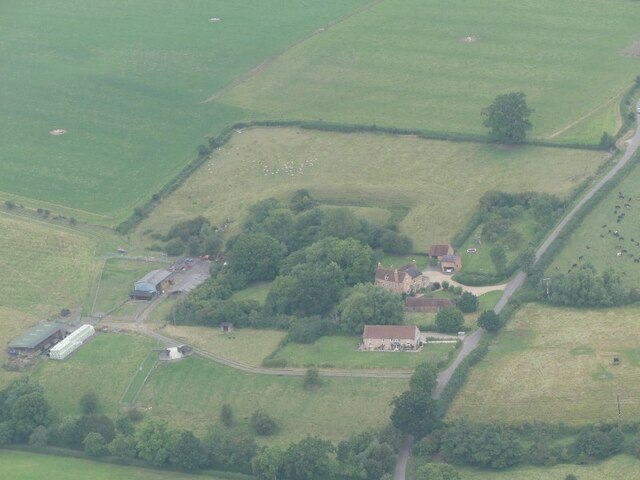
Image: © Simon Tomson Taken: 16 Aug 2021
The monument survives well and remains largely unencumbered by modern development. It represents a good example of two moated sites constructed within close proximity to each other with valuable documentary information concerning their layout. Evidence for the design and function of the manor house which occupied the southern moated island and for structures which occupied the northern moated island will survive beneath the ground surface. Additionally organic material will be preserved within the waterfilled moat ditches of the southern moated site. The site retains well preserved remains of an extensive fishpond system, and the whole complex is set within units of ridge and furrow, the development of which will inform discussion of the date and character of occupation of the various parts of the site. See https://historicengland.org.uk/listing/the-list/list-entry/1011196
Images are licensed for reuse under creativecommons.org/licenses/by-sa/2.0
Image Location
Latitude
52.244272
Longitude
-1.632634