Close view of top of wall at junction of Clints Road with Sandy Lane
Introduction
The photograph on this page of Close view of top of wall at junction of Clints Road with Sandy Lane by Roger Templeman as part of the Geograph project.
The Geograph project started in 2005 with the aim of publishing, organising and preserving representative images for every square kilometre of Great Britain, Ireland and the Isle of Man.

There are currently over 7.5m images from over 14,400 individuals and you can help contribute to the project by visiting https://www.geograph.org.uk
Close view of top of wall at junction of Clints Road with Sandy Lane
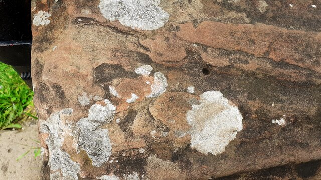
Image: © Roger Templeman Taken: 31 Aug 2021
Ordnance Survey records indicate that a pivot benchmark levelled at 43.520m above Newlyn Datum was verified in 1972 on top of the wall here (see www.bench-marks.org.uk/bm142613 ). This image shows what might be a hole for a rivet and suggestion of arrow cuts. Adrian Taylor has a different opinion Image reporting the mark's demise which may well be correct!
Images are licensed for reuse under creativecommons.org/licenses/by-sa/2.0
Image Location
Latitude
54.883105
Longitude
-2.820631