Brooklyn Road, Foleshill, seen from the towpath of the Coventry Canal
Introduction
The photograph on this page of Brooklyn Road, Foleshill, seen from the towpath of the Coventry Canal by A J Paxton as part of the Geograph project.
The Geograph project started in 2005 with the aim of publishing, organising and preserving representative images for every square kilometre of Great Britain, Ireland and the Isle of Man.

There are currently over 7.5m images from over 14,400 individuals and you can help contribute to the project by visiting https://www.geograph.org.uk
Brooklyn Road, Foleshill, seen from the towpath of the Coventry Canal
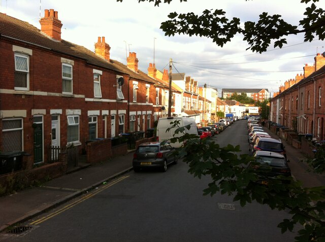
Image: © A J Paxton Taken: 26 Aug 2021
Brooklyn Road and its neighbour Matlock Road are a pair of dead-end streets that form part of a block of housing developed from 1901 in an area bounded by the canal, Foleshill Road and Cash's textile factory (the 'Hundred Houses'). See Fry, D & Smith, A, The Coventry we have lost: Forgotten Foleshill, Simanda Press, 2018, p19. In the distance can be seen new housing beyond Foleshill Road, built on the site of Webster's Brick & Tile Works.
Images are licensed for reuse under creativecommons.org/licenses/by-sa/2.0
Image Location
Latitude
52.42227
Longitude
-1.506606