Matlock Road and Sutherland House, seen from the Coventry Canal
Introduction
The photograph on this page of Matlock Road and Sutherland House, seen from the Coventry Canal by A J Paxton as part of the Geograph project.
The Geograph project started in 2005 with the aim of publishing, organising and preserving representative images for every square kilometre of Great Britain, Ireland and the Isle of Man.

There are currently over 7.5m images from over 14,400 individuals and you can help contribute to the project by visiting https://www.geograph.org.uk
Matlock Road and Sutherland House, seen from the Coventry Canal
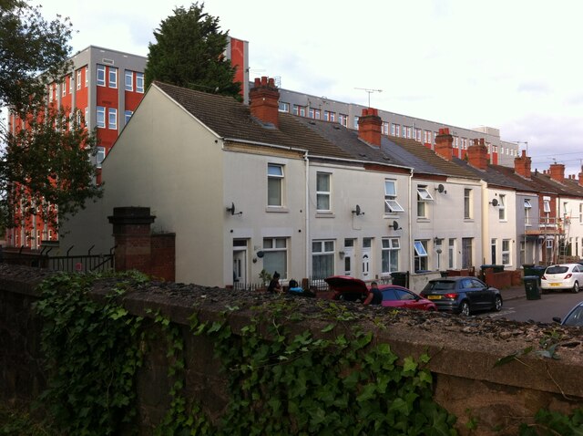
Image: © A J Paxton Taken: 26 Aug 2021
Matlock Road and its neighbour Brooklyn Road are a pair of dead-end streets that form part of a block of Coventry housing developed from 1901 in an area bounded by the canal, Foleshill Road and Cash's textile factory (the 'Hundred Houses'). Many of the red brick houses have now been given an external insulating cladding to improve thermal efficiency. Behind the row of houses can be seen Sutherland House, built in the early 1930s as part of the Courtaulds textile factory and now converted into offices. See Fry, D & Smith, A, The Coventry we have lost: Forgotten Foleshill, Simanda Press, 2018, p19.
Images are licensed for reuse under creativecommons.org/licenses/by-sa/2.0
Image Location
Latitude
52.422988
Longitude
-1.506304