Old Boundary Marker on the B3168 in Ilminster
Introduction
The photograph on this page of Old Boundary Marker on the B3168 in Ilminster by A Rosevear as part of the Geograph project.
The Geograph project started in 2005 with the aim of publishing, organising and preserving representative images for every square kilometre of Great Britain, Ireland and the Isle of Man.

There are currently over 7.5m images from over 14,400 individuals and you can help contribute to the project by visiting https://www.geograph.org.uk
Old Boundary Marker on the B3168 in Ilminster
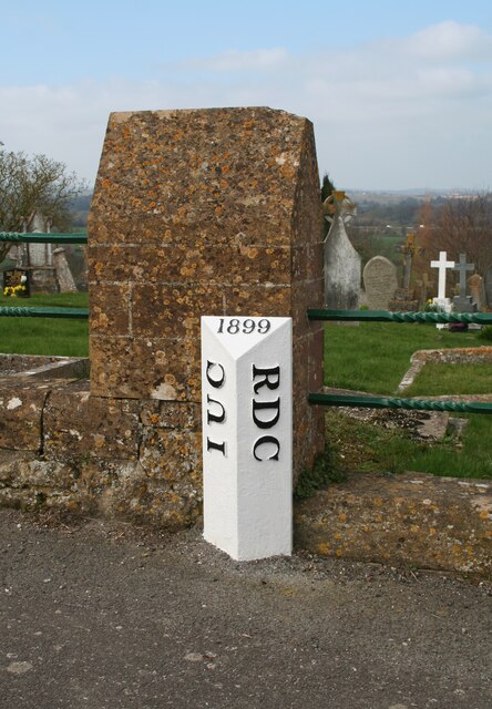
Image: © A Rosevear Taken: 2 Mar 2011
Municipal Boundary Marker against the low stone wall of the cemetery on the northwest side of the B3168 between Beacon and Ashwell. Ilminster Urban District was created in 1899 and this post marks the boundary of Ilminster parish and Urban District and Ilminster Without parish in Chard Rural District. Now entirely in Ilminster parish. Grade II Listed https://historicengland.org.uk/listing/the-list/list-entry/1345843. Milestone Society National ID: SO_LPIM09pb
Images are licensed for reuse under creativecommons.org/licenses/by-sa/2.0
Image Location


Leaflet Map data © OpenStreetMap
Latitude
50.936768
Longitude
-2.912747