Old Boundary Marker on Moolham Lane, Ilminster
Introduction
The photograph on this page of Old Boundary Marker on Moolham Lane, Ilminster by A Rosevear as part of the Geograph project.
The Geograph project started in 2005 with the aim of publishing, organising and preserving representative images for every square kilometre of Great Britain, Ireland and the Isle of Man.

There are currently over 7.5m images from over 14,400 individuals and you can help contribute to the project by visiting https://www.geograph.org.uk
Old Boundary Marker on Moolham Lane, Ilminster
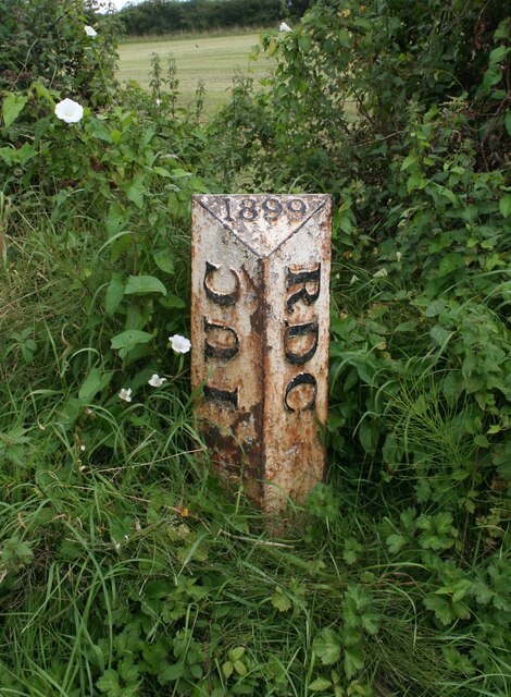
Image: © A Rosevear Taken: 29 Aug 2009
Municipal Boundary Marker on the east side of the T junction at the west end of Moolham Lane. Ilminster Urban District was created in 1899 and this post marks the boundary of Ilminster parish and Urban District and Ilminster Without parish in Chard Rural District. Now entirely in Ilminster parish. Milestone Society National ID: SO_IMCH01pb
Images are licensed for reuse under creativecommons.org/licenses/by-sa/2.0
Image Location
Latitude
50.91747
Longitude
-2.912796