
Blocked street gulley
Introduction
The photograph on this page of Blocked street gulley by M J Richardson as part of the Geograph project.
The Geograph project started in 2005 with the aim of publishing, organising and preserving representative images for every square kilometre of Great Britain, Ireland and the Isle of Man.

There are currently over 7.5m images from over 14,400 individuals and you can help contribute to the project by visiting https://www.geograph.org.uk
Blocked street gulley
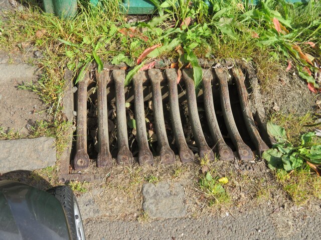
Image: © M J Richardson Taken: 18 Aug 2021
An ever increasing feature of Edinburgh's streets, and a contributor to domestic and commercial flooding in the city. Once upon a time the council had a rota to clear all gulleys twice a year. Now they have no systematic programme, but depend on calls from property owners at risk of flooding [see Image] which, of course, happens after heavy rain. All of a sudden, 2-3 months of gulley-cleaning needs to be done NOW, or even preferably before the inundation.
Images are licensed for reuse under creativecommons.org/licenses/by-sa/2.0
Image Location

Latitude
55.91593
Longitude
-3.204712