Norton houses [1]
Introduction
The photograph on this page of Norton houses [1] by Michael Dibb as part of the Geograph project.
The Geograph project started in 2005 with the aim of publishing, organising and preserving representative images for every square kilometre of Great Britain, Ireland and the Isle of Man.

There are currently over 7.5m images from over 14,400 individuals and you can help contribute to the project by visiting https://www.geograph.org.uk
Norton houses [1]
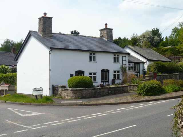
Image: © Michael Dibb Taken: 1 Jun 2021
The former post office at the junction of Mynd Road and the B4355 road. The building is partly medieval but was mostly rebuilt in the late 18th or early 19th century and it retains half of a late medieval open-hall with one cruck-truss remaining. The construction is partly timber framed and rendered, partly rubble stone, all under a slate roof. Listed, grade II, with details at: https://cadwpublic-api.azurewebsites.net/reports/listedbuilding/FullReport?lang=&id=8946 Norton is a small, rural villages astride the B4355 road some 2 miles north of Presteigne and some 3½ miles south of Knighton. The village was a planned settlement around the Norman castle.
Images are licensed for reuse under creativecommons.org/licenses/by-sa/2.0
Image Location
Latitude
52.298856
Longitude
-3.022046