Knighton houses [20]
Introduction
The photograph on this page of Knighton houses [20] by Michael Dibb as part of the Geograph project.
The Geograph project started in 2005 with the aim of publishing, organising and preserving representative images for every square kilometre of Great Britain, Ireland and the Isle of Man.

There are currently over 7.5m images from over 14,400 individuals and you can help contribute to the project by visiting https://www.geograph.org.uk
Knighton houses [20]
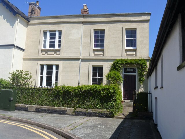
Image: © Michael Dibb Taken: 31 May 2021
Burford House, number 1 Wylcwm Street, is an early or mid 19th century house. The front is rendered and lined to simulate ashlar, all under a slate roof. Listed, grade II, with details at: https://cadwpublic-api.azurewebsites.net/reports/listedbuilding/FullReport?lang=&id=9030 Knighton is a somewhat remote market town gaining its charter in 1203. It is sited on the River Teme some 60 miles north of Cardiff. It lies on the Welsh/English border, with a small part in Shropshire, including its railway station. Originally an Anglo-Saxon settlement, Knighton is located on Offa's Dyke, the ancient earthwork that divided the two countries. It later became a Norman defensive border town.
Images are licensed for reuse under creativecommons.org/licenses/by-sa/2.0
Image Location
Latitude
52.344211
Longitude
-3.0479