OS Bench Mark - inverted
Introduction
The photograph on this page of OS Bench Mark - inverted by Phil Johnstone as part of the Geograph project.
The Geograph project started in 2005 with the aim of publishing, organising and preserving representative images for every square kilometre of Great Britain, Ireland and the Isle of Man.

There are currently over 7.5m images from over 14,400 individuals and you can help contribute to the project by visiting https://www.geograph.org.uk
OS Bench Mark - inverted
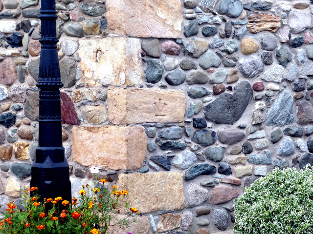
Image: © Phil Johnstone Taken: 24 Aug 2021
Old 25" OS maps show a bench mark on the corner of this house on Pilling Lane. The house seems to have been rebuilt using the original stones and the bench mark has been turned upside down. See Image for another example just along the lane.
Images are licensed for reuse under creativecommons.org/licenses/by-sa/2.0
Image Location


Leaflet Map data © OpenStreetMap
Latitude
53.936183
Longitude
-2.956541