Stoke Bottom Lock near Stoke-on-Trent
Introduction
The photograph on this page of Stoke Bottom Lock near Stoke-on-Trent by Roger Kidd as part of the Geograph project.
The Geograph project started in 2005 with the aim of publishing, organising and preserving representative images for every square kilometre of Great Britain, Ireland and the Isle of Man.

There are currently over 7.5m images from over 14,400 individuals and you can help contribute to the project by visiting https://www.geograph.org.uk
Stoke Bottom Lock near Stoke-on-Trent
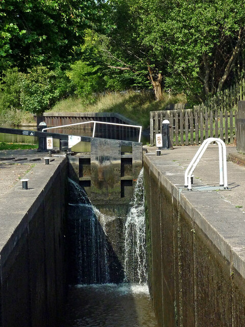
Image: © Roger Kidd Taken: 10 Sep 2014
Looking north-west towards Etruria. Stoke Bottom Lock is No 36 on the Trent and Mersey Canal north-west of Stoke-on-Trent railway station. The Stoke flight of five locks provides a rise (or fall) of fifty feet (15·25 metres). This lock is slow to fill for some reason, so queues often form. Vernon Road is behind the camera, but prior to the extensive local regeneration there was no bridge adjacent to the lock.
Images are licensed for reuse under creativecommons.org/licenses/by-sa/2.0
Image Location
Latitude
53.010083
Longitude
-2.18581