Parson's Nose
Introduction
The photograph on this page of Parson's Nose by Simon Carey as part of the Geograph project.
The Geograph project started in 2005 with the aim of publishing, organising and preserving representative images for every square kilometre of Great Britain, Ireland and the Isle of Man.

There are currently over 7.5m images from over 14,400 individuals and you can help contribute to the project by visiting https://www.geograph.org.uk
Parson's Nose
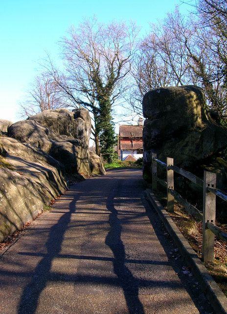
Image: © Simon Carey Taken: 17 Feb 2008
That is the name of the rock on the right, which has also been known as Old Man's Head and the Pulpit. Many of the names were given by local Victorian guides to attract the tourists to the Denny Bottom Rocks. Between the rocks is an actual road, Rusthall Park, on its way to the junction with Harmony Street.
Images are licensed for reuse under creativecommons.org/licenses/by-sa/2.0
Image Location
Latitude
51.133468
Longitude
0.240984