Yeadon, Haw Lane
Introduction
The photograph on this page of Yeadon, Haw Lane by Mel Towler as part of the Geograph project.
The Geograph project started in 2005 with the aim of publishing, organising and preserving representative images for every square kilometre of Great Britain, Ireland and the Isle of Man.

There are currently over 7.5m images from over 14,400 individuals and you can help contribute to the project by visiting https://www.geograph.org.uk
Yeadon, Haw Lane
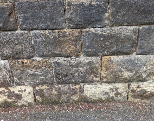
Image: © Mel Towler Taken: 7 Aug 2021
This boundary wall on Haw Lane is in front of Number 16 and 18 Haw Lane, and on the east side of the road. There is a benchmark cut into the second course of stones, about 1 foot from ground level.
Images are licensed for reuse under creativecommons.org/licenses/by-sa/2.0
Image Location
Latitude
53.868485
Longitude
-1.684107